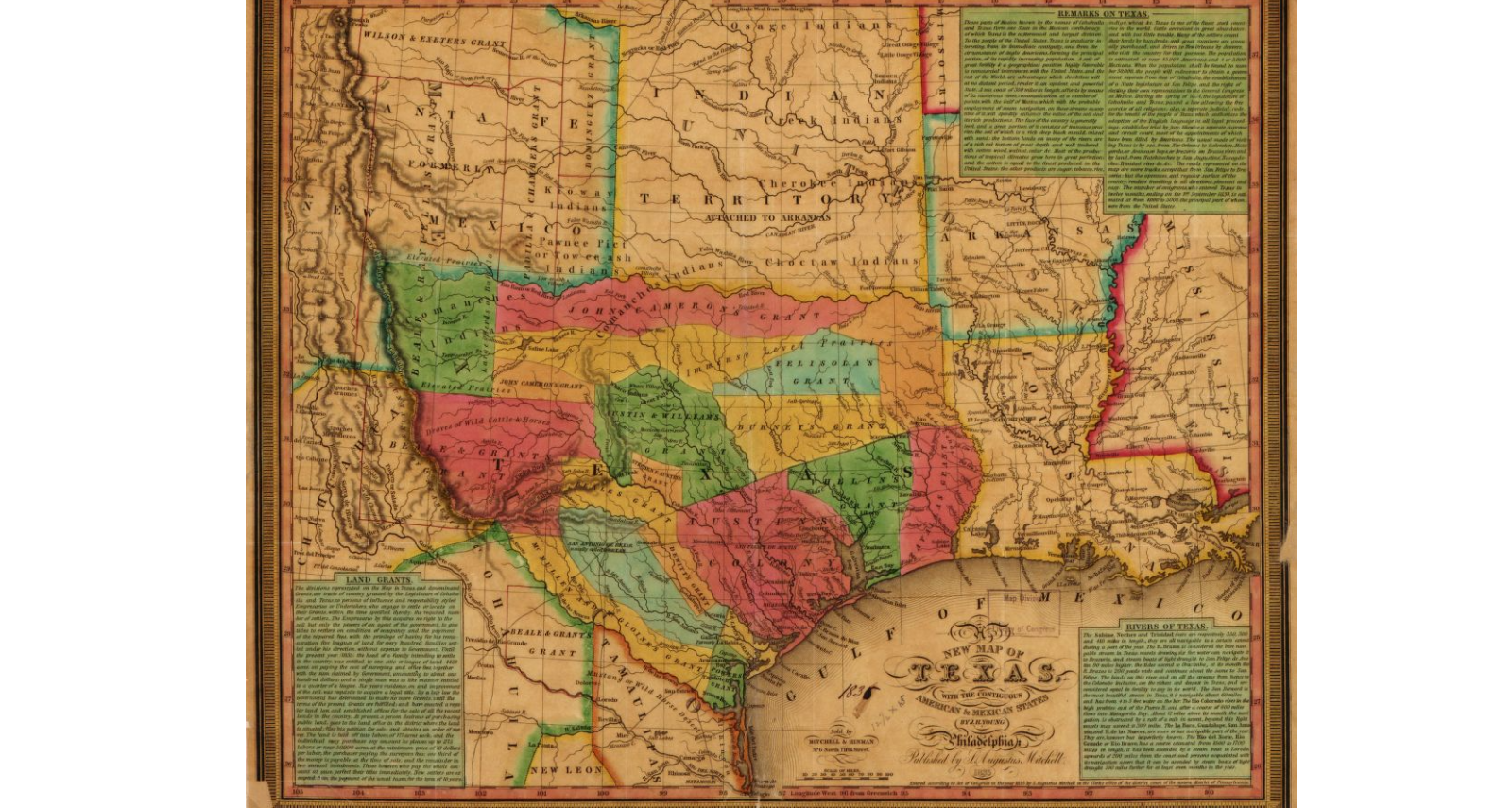
Map shows colonies and land grants, Neuces River as border between Texas and Mexican states, Indian Territory attached to Arkansas, Santa Fe area, towns, rivers, and roads.
This was engraved by James H. Young in 1835. This map is part of the map collection at the Geography and Map Division, Library of Congress.
| Document Type: | Map |
| Historical Event: | Statehood (1912) |
| Sub Event: | Land Grants |
| Origin: | Geography and Map Division, Library of Congress |
| Date: | |
| Author: | James H. Young and S. Augustus Mitchell |
| Permission: | Public Domain |
| Contributor: | Tammie Torres |
Digital Text:
Related Documents
- Chilili Demands Presented
- Spanish-American Family Farm
- Tributary of the Rio Costilla
- Rio Hondo Land
- Railroad Land Grants - NM Territory
- Judge McFie's Baby Case in the Supreme Court
- Joseph's Joint Resolution
- Simms' Mesa Tract Will Be Fully Developed
- Under heading: Monday, March 2
- Advertisement: The Maxwell Land Grant
- ARTICLE II, Bill of Rights
An educational resource for New Mexico high school history programs.
