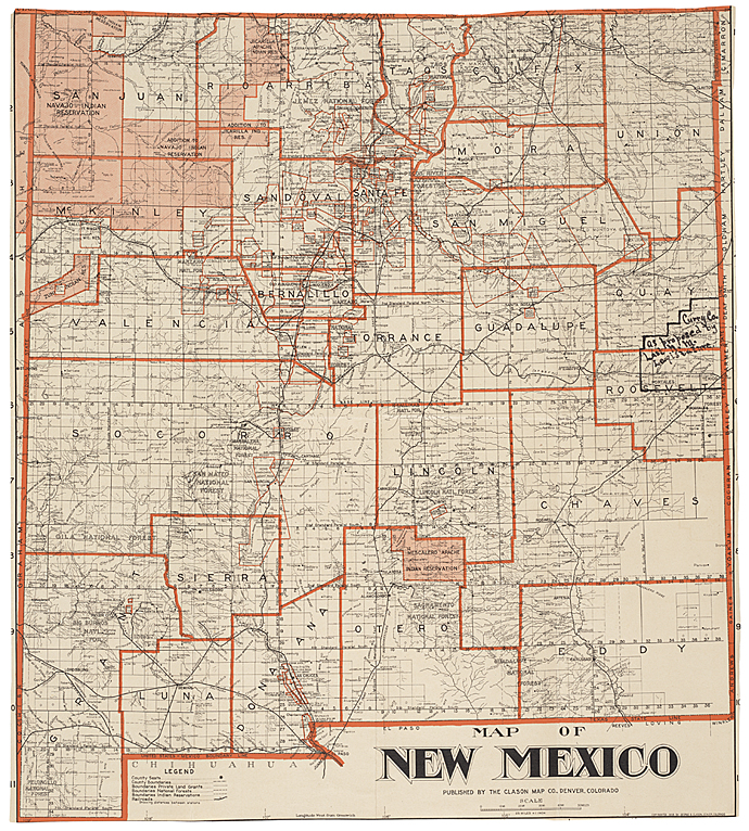
This map shows the New Mexico county boundaries as they existed in 1908 when the territory was seeking statehood. It also shows the proposed Curry County, named after then-Territorial Governor George Curry, which became a county in 1909.
RG 233, Records of the U.S. House of Representatives
| Document Type: | Map |
| Historical Event: | Statehood (1912) |
| Sub Event: | Borders and Counties |
| Origin: | Legislative Archives, National Archives |
| Date: | |
| Author: | Clason Map Company |
| Permission: | Public Domain |
| Contributor: | Tammie Torres |
Digital Text:
Related Documents
- Map of US with NM - 1847
- Map of Railroads
- Map of NM with Coach Lines, Rivers and Lakes
- Santa Fe Route 1888
- Bernalillio County Courthouse 1908
- ARTICLE I, Name and Boundaries; and ARTICLE X, County and Municipal Corporations
An educational resource for New Mexico high school history programs.
