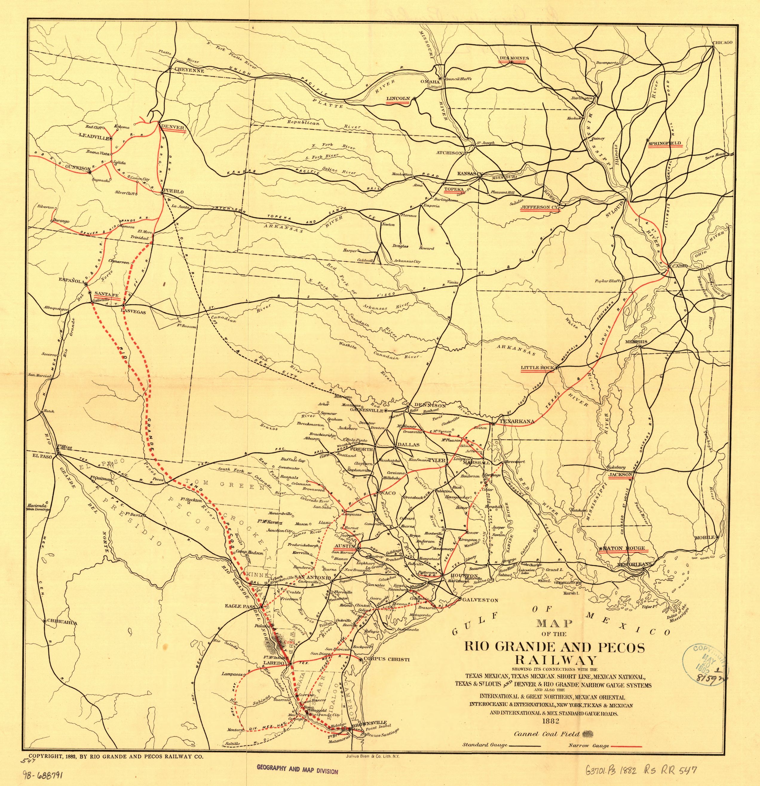
Map of the Rio Grande and Pecos Railway showing its connections with the Texas Mexican, Texas Mexican Short Line, Mexican National, Texas & St. Louis, and Denver & Rio Grande Narrow Gauge systems and also the International & Great Northern, Mexican Oriental Interoceanic & International, New York, Texas & Mexican and International & Mex. Standard Gauge roads. This map was published in 1882 by Julius Bien & Co, part of the Railroad Maps Collection of the Library of Congress.
| Document Type: | Map |
| Historical Event: | Statehood (1912) |
| Sub Event: | Borders and Counties |
| Origin: | Railroad Maps Collection, Library of Congress |
| Date: | |
| Author: | Julius Bien & Co. |
| Permission: | Public Domain |
| Contributor: | Tammie Torres |
Digital Text:
Related Documents
- Map of US with NM - 1847
- Map of NM with Coach Lines, Rivers and Lakes
- Santa Fe Route 1888
- Bernalillio County Courthouse 1908
- Map of NM Showing County Seats and Boundaries 1908
- ARTICLE I, Name and Boundaries; and ARTICLE X, County and Municipal Corporations
An educational resource for New Mexico high school history programs.
