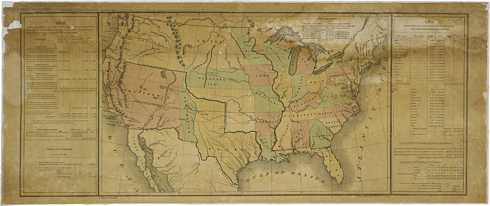
This is the Map of Western Territories that President James K. Polk sent to Congress with his annual message in 1848. The map shows the New Mexico territory as the boundaries were established by various treaties, such as the Treaty of Guadalupe Hidalgo. This map is part of the House of Representatives Collection from the Center for Legislative Archives, of the National Archives and Records Administration.
| Document Type: | Map |
| Historical Event: | Statehood (1912) |
| Sub Event: | US Government Role |
| Origin: | Center for Legislative Archives, National Archives |
| Date: | |
| Author: | Not Cited |
| Permission: | Public Domain |
| Contributor: | Tammie Torres |
Digital Text:
Related Documents
- Public Meeting Information 1864
- Fillmore's Nomination of James S. Calhoun as 1st Governor of NM Territory
- Admission to Statehood
- Memorial of the Territory of New Mexico Seeking Admission as a State
- 1912 Electoral Vote Tally
- The Next Candidate for Statehood
- Waiting for their Stars
- Greeting President Roosevelt at Albuquerque
- William Taft Signing NM Statehood Bill
- Joint Resolution 14 to Admit Arizona and New Mexico to US
- Credentials for the first US Senators from NM
- Enters the Sisterhood of States
- ARTICLE XXI, Compact with the United States
An educational resource for New Mexico high school history programs.
